

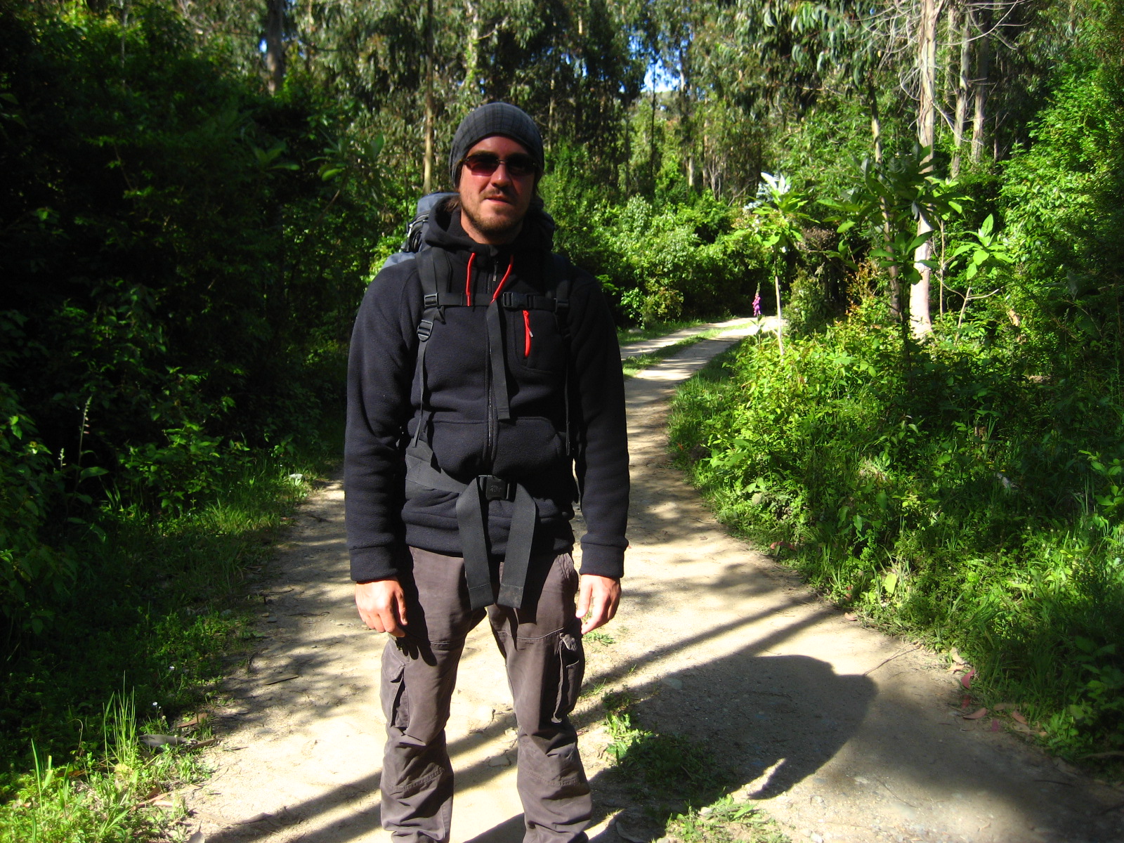
This is the start of an extraordinary trip into the wild. Reserva Costera Valdiviana was our target and we planned to camp for two nights on the beach. It was a reasonably early start to the day as we had to leave enough time to firstly get to the park perimeter and secondly walk the through the park to our destination, Playa Colun. The walk from the perimeter is approximately 12km. We took two backpacks with a tent, sleeping bags, stove, gas, pot, pan, newspaper, Leatherman, gaffa tape, elastic bungee clothes line, clothes, water and food. It wasn’t as light as I thought it would be, but the weight was OK. We started with breakfast and then promptly left the house and walked about 1km down the road to where the small ferry left for Corral, across the estuary. It was a glorious start to the day, a plenty of sun and a nice cool breeze.
When we arrived in Corral, the plan was to take a bus to the park entrance, however when we got to the bus stop, the bus wasn’t due for a couple of hours. We decided to walk a bit further out of town towards the park, to increase our chances of hitch-hiking. We walked and walked, through a couple of small villages and finally gave up trying after finding out that no cars were going where we wanted to go. So we found a small shop with a tad of shade and ice cream to chill out at until the bus came. This was a good 5 km walk down the road. We still needed to calculate approximately another 12 km in, so we took it easy.
Eventually the bus came and we were on our way. We soon found out why not many people drove to the village next to the park entrance. The road soon after we got on the bus is a rough gravel road, currently under construction. Part of the new surface was already laid, but we drove a good 15 km on gravel. Not a very nice journey, even on the bus it was a pretty hard bounce! Tourists were not to be seen here. We’re pretty sure the road puts people off from travelling along it and the national park is also not that known as far as we heard from our locals. Great for us I suppose as we don’t really like the tourist trails and herds of zombies :p
Arriving at the village of Chaihuin next to the entrance to the park, we noticed how deserted the place was. There wasn’t much movement going on at all. The small bus and tourist information building was unmanned and we only saw a couple of cars driving around. We quickly crossed the bridge into the park and started walking the long road. We knew approximately where we were going as Felipe’s housemate Matt who actually left that day to start travelling the south of Chile, drew us a very nice map of the route to Playa Colun. This hand drawn map had Ordinance Survey standard qualities as Matt was actually studying geology at the time. He also did the same route a while back, so he knew exactly the best route of how to get there. Funny thing is, we naturally forgot the map back at the house. Duh! We did however take a picture of the park map at the entrance and remembered key points that Matt mentioned to guide us to our goal.
Along the way we heard a car coming from behind us. We stuck our thumbs out and hey presto! We got a ride with one of the park rangers :) The first part of the park is mainly a wide gravel road that eventually fans out into many smaller tracks along the way. He took us about 5 km along the road and he gave us some tips as to where we could find the correct route. “A black gate on the right, when the road gets thinner” he said. He didn’t take us all the way to the gate, so we had to walk another 2 km to get there. After a nice cheese and egg sandwich lunch and locating the correct gate, the whole scenery started to change quite dramatically. We walked into what looked like a type of highly vegetated rain forest on a fairly used track, primarily used by 4x4s, as with a normal car you might get into issues. A bit further along the track we start to hear the sea and we found the Gringo house that Matt mentioned a few times when explaining the route.
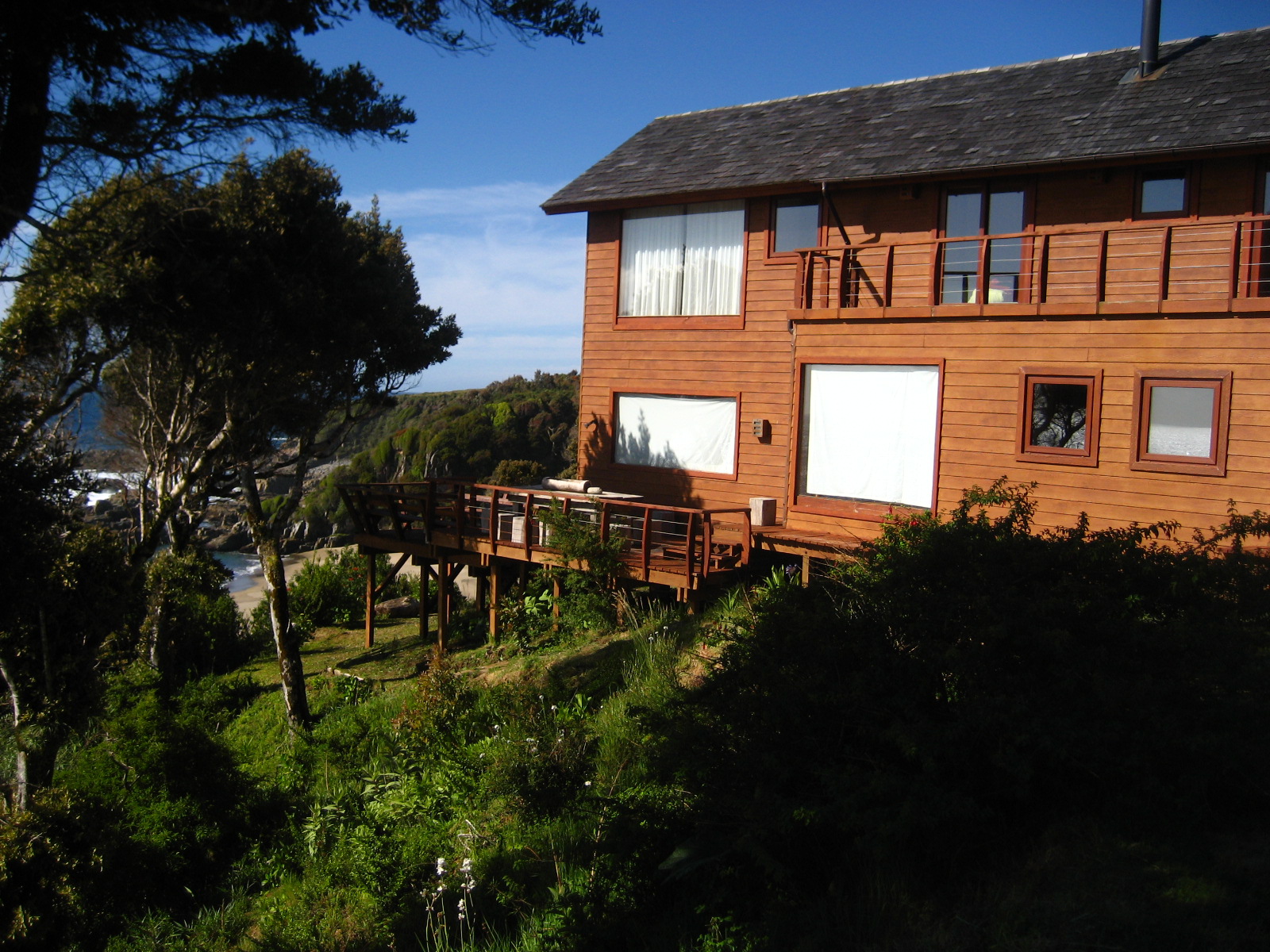
A nice house it was indeed! The views from the top of the cliff where the house was situated were incredible! It had a perfect terrace overlooking the beach and a path leading down to it. This huge beach basically belonged to the house as nobody goes to this beach as access is a bit tricky. We sneaked into the property to take a few pictures after taking a small break and noticing that no one was at home. It’s an admirable house in a stunning location. Something most people only dream of having access to. After marveling at the house, we moved on, heading along the coastline towards our next way-point, the golf course. Matt mentioned we should bump into it and not to walk the whole way down it but to turn left before. We did bump into it and we were quite astounded by the size of this fairway situated in the middle of nowhere! There was only a small hut at the end of the fairway and no other buildings. No club house, restaurant or even a reception. Nobody to be seen!
I thought for a while about it as the whole concept of a golf course here was confusing me a bit. There was a huge fairway and another open area near the end of it that also looked like a fairway with a hole at the end. But as far as I could see, that was it! Hmm, it didn’t add up. But then it came to me, it looked like a runway! What a sneaky idea, to build such a huge fairway and claim it’s a golf course, but to use it as a private airport. I’m sure this was the case as after looking at Google maps satellite images, you can see areas of wear and tear, obviously where the planes had touched down. I believe this is how the Gringos arrive here for the weekend from Santiago. I also think that they knew the administration would refuse planning permission for cutting down trees within a national park for a private landing strip. But hey, if it’s a golf course it’s all good right ;)

We carried on down the path and we could hear the waves breaking on Playa Colun. We were getting close. The golf course was our final clue and way-point, so the rest of the journey we had to figure out ourselves. We had the picture of the map on the camera that helped and the sun as a compass. We got to a turning point where three tracks joined and we stopped to think for a bit. Our original goal of heading to the end of Playa Colun, where the river, lakes, sand dunes and caves were, started to look a bit unrealistic as the sun was on its way to bed so we had only a couple of hours of sunlight left, tops! We could have made it, but we were already feeling quite knackered after all the walking we did. The park ranger we met earlier mentioned that there was a good camping site with a stream near the beginning of Playa Colun. We decided to head for that. The problem was that we didn’t quite know which trail to choose.
If we went down the wrong trail, we would end up walking all the way back up 100 m to where we turned off, as we were quite high at that point. Victoria would also be on my case as she was getting pretty tired and hungry. So was I at that point, so the decision had to be a good one. I worked out roughly how far we walked from the golf course and checked it with the map. It looked like we were in the right place, according to the map, although the map was pretty vague in terms of showing all the trails. The trail heading towards the faint sound of the sea and the west setting sun felt like a good one to take. Victoria really wasn’t sure, as it was a bit of a side trail and it basically left the main trail we were on. I insisted on taking it, so we started heading down the path. I also wasn’t sure it was correct, but after we arrived at a very steep, stoned path meandering down to the beach we felt extremely relieved as we knew it was Playa Colun. We stumbled upon a magnificent viewpoint up on the cliffs, looking down over the whole beach. I was speechless for a while. I hadn’t seen such an untouched, raw, beautiful landscape in a very long time, if ever. It was the combination of raw nature, no humans in sight for a few hours, trekking the whole day and beauty that made it so special to arrive there. It was fantastic :) A feeling I will never forget.

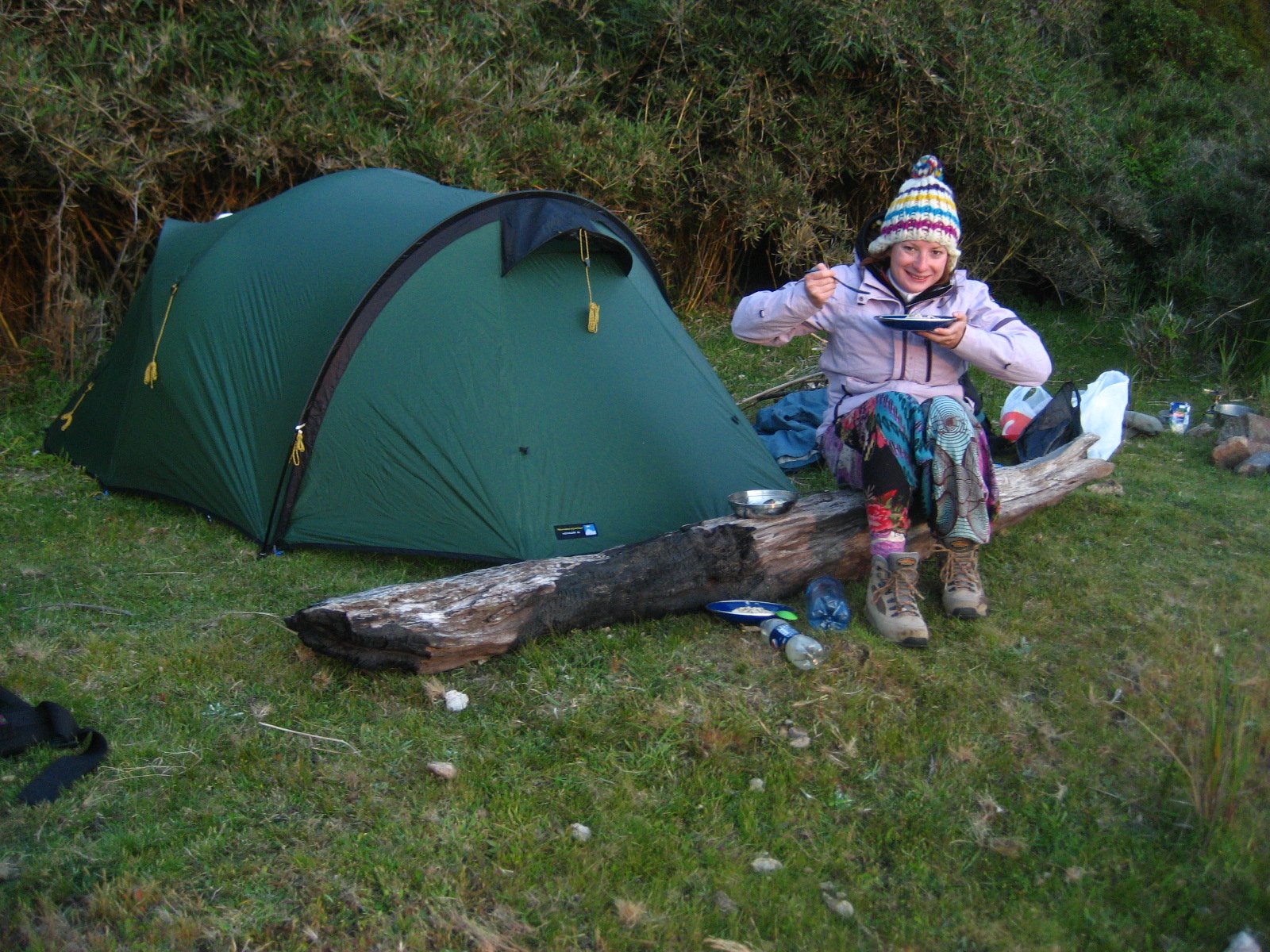
When we arrived at the bottom, next to the dunes and beach, we quickly found a great place to set up camp with a nearby fresh water stream, drift wood, wind shelter from bamboos and green grass. The sun was getting pretty low at this point so the first priority was to set up the tent. Shortly after I went to look for driftwood for the fire and while doing so I found some nice stones to put around the fire and logs to use as seats and wind break for the tent. It was getting pretty chilly at this point as there was a fairly strong breeze coming from the sea to the west. The temperature was dropping rapidly, so I started the fire and Victoria prepared the food; Tuna pasta with cream and a freshly chopped salad with vegetables on the side. We also had a nice bottle of red wine to accompany our feast! The tent was up, blow up mattresses inflated and sleeping bags unpacked. Everything was ready for a good night sleep. The only worry I had when sleeping was: would you get any warning if a tsunami was on the way? Chile is situated right next to a ridge where earthquakes occur and can create nasty tsunamis. Probably not, so sleeping on the beach has its risks naturally. But, it also has its pleasures. These pleasures certainly outweigh the risks. You have to be seriously unlucky to get hit by one of those. Wouldn’t that be a worst case scenario when waking up? Something best not to think about I found.
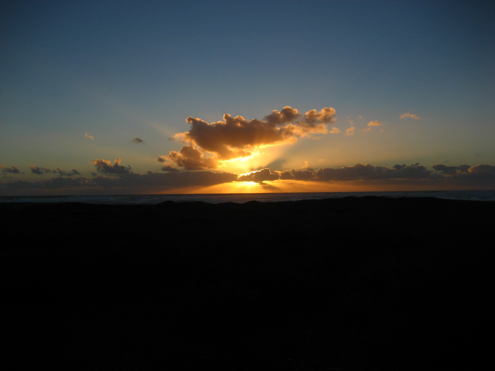
Together we watched the sun set over the Pacific while eating and sitting next to the fire. Everything was just incredible! The food tasted great, the view looked amazing, the sounds added to the atmosphere and the air smelt incredible! All our senses were just going wild and at the same time I felt even a bit scared you could say. Dominated and intimidated by nature perhaps. It was a strange but interesting combination of feelings that I have never felt before and that I can’t quite describe with words. I will try to describe it; It’s like a reaction that happens to the body when all the securities and things that you are used to and take for granted like nearby doctors, neighbors family, friends, shops, showers, taps, toilets, computers, internet, mobile phone reception, to name a few are all taken away. All left behind and now unreachable. We were detached from humanity, community and left with pure nature. Feeling so far from the rest of the world made me think. What if this happened or that happened… Where would you run? What would you do? You can’t call anyone! It brought me back down to earth. It was a matter of going back to basics. Many people lived and still live in this way, with limited resources and no internet access, it makes one think… what does one really need to survive or even to enjoy life? I think the best thing was just not to worry. Fear is the mind killer so just go with the flow and be prepared for whatever comes your way. That’s all you can do.
It was a glorious day, a day to remember. A day full of up’s and down’s, both geologically and psychologically, but the end nearly always justifies the means ;)

We slept like puppies. The next day we went for a trek to the end of the beach and back. The wide, sandy beach is 10 km long with a row of small dunes before a pretty big cliff. Further down it changes dramatically as the cliffs turn into some amazing sand dunes, surrounded by a river, lakes, green fields and forests. We reached the end of the beach where the river splits the beach. Here we had lunch next to the river. While having our lovely packet soup prepared with a mix of river and sea water, (pretty salty as we later found out) we saw our first humans for quite a while on the other side of the river doing some fishing. It was quite a surprise to us, as we thought that nobody was here in this park with us. It just felt really remote when walking the beach. We saw another boat come down the river too with a family. They moored up their boat and walked up a hill somewhere. We later found out that the house they were going to was one of the most amazing locations for a house that we’ve ever seen. If that place is for rent, I think we’re going back some time. It was quite a small house built right on top of the hill with a large round terrace overlooking the river, beach, sand dunes, green fields and forests. The views from there must have been amazing!

We decided to walk back a different way, as we heard that there were caves to explore. We walked straight over the fields heading north, in parallel with the beach but on the other side of the huge sand dunes. We followed the edge of the dunes next to the forest and we bumped into the caves we were looking for. We weren’t too sure where they were located as we were only told approximately where they were. The entrances to the caves were quite small, but once you were inside they opened up enough to pitch a tent! These caves were our initial target for day one, but we had to pitch at the north end of the beach before the sun set. Good thing we did as the caves seemed a bit gloomy. We carried on into the dense forest, trying to find any sign of a path to guide us through. We did find used tracks in the ground, but these were mostly made by cattle. After many dead ends, we eventually found a footpath leading up a small valley into the hills surrounding the lakes.

From the footpath we could just about see the lakes as we passed them. There was no clear view of the lakes, but judging from the map, we were on the right track heading back to the north side of the beach where our tent was. There were times when walking along the path where we had to make educated decisions about which path to follow as there were a few choices along the way, but using the sun as a compass while following the more worn paths we managed to get back to base camp. It was quite a mission as from one end of the beach to the other was about 10 km. It took about 2 hours to walk down the beach, but on the hilly, jungle route back, it took a good 3 hours to return. By this time we had clocked up a nice 20 km of walking while sharing a backpack with extra clothes, food and cooking equipment.
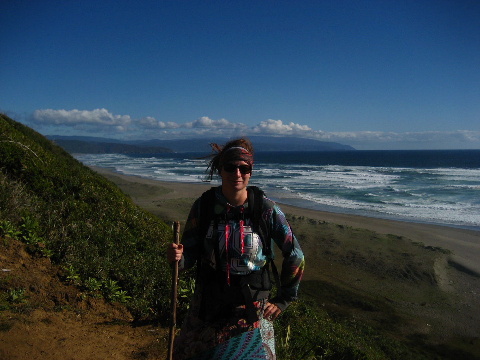
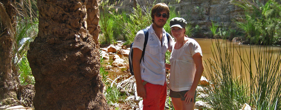
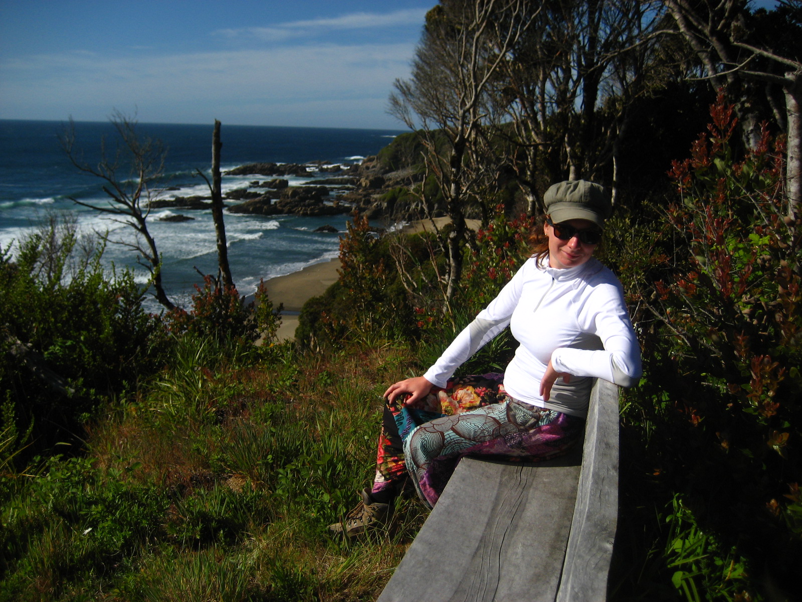
And what a relief it was to find the right combinations of paths back. Now and again, Victoria would ask me “are you sure?”. I wasn’t that sure at times but I made myself look confident. Victoria didn’t want to walk any more than she had to towards the end of the journey. Nor did I, as we were both very tired and exhausted by that point, so backtracking would probably end in frustration. So here is a picture of the view above the north end where we were camped and happy Victoria near the end of our trek. At this point we were over the moon to get back before sunset, as we still had to rest for a bit and prepare a well-earned meal. We arrived and the tent hoping everything would still be there, and thankfully so it was. I was more than certain that nothing would happen to our equipment as we didn’t see anyone in that area and even if there was, you have to be pretty unlucky that some idiot would take your stuff.

After a short rest, we both got to work. I prepared the fire with some kindling that we found and covered up the night before, while Victoria prepared the food for cooking. After the fire got going I went to find some more substantial pieces of wood to keep the burner going. The meal for tonight would be a rice and vegetable pot, with a good helping of salt and pepper. I can tell you now that the food went down a treat! While we were cooking, three guys all on horseback looking like Chilean cowboys surprisingly turned up and warned us about a Puma that they saw on the beach earlier that day. How nice of them to inform us! After our short conversation they rode off into the sunset and we sat next to the fire and enjoyed the rest of the evening with a lovely Cuban rum that we picked up while in Cuba.

While watching the sunset we noticed various shapes being formed by the clouds. The clouds in this picture look like a polar bear and to the right, I thought it looked like the symbol for PI. During both sunsets here we saw clouds that looked like a crocodile and your common submarine; simply amazing artwork going on in the skies. As the evening got darker, the stars appeared giving us an awesome display of the milky way and various star constellations like the Crux (southern cross), which is only seen clearly all year round in the southern hemisphere. That night I went to bed with a knife next to me, as the proposition of a hungry Puma coming our way was slightly concerning. It took me a while to fall asleep that night after running through various possibilities of a Puma attack through my head and how I would respond in such events. After preparing myself and purposely leaving my earplugs out, I slept like a baby.

The next day came and we were still in one piece! Neither puma, nor tsunami came our way, so we packed our stuff and started the trek back to Valdivia. We had a small pocket of sun in the morning, enough to dry out most of the tent, which is always a good thing. A wet tent and damp sleeping bag always adds to the weight of the bag. Just after we left base camp, clouds started to move in and it started to drizzle. It wasn’t cold at all as we were well dressed for the occasion and the clouds kept the warmth in. It kept drizzling through most of the walk, but when we made it back to the main, gravel road leading into the national park it cleared up and the sun shone through. We walked for about an hour down the gravel road and luckily, one 4×4 was going in our direction. I was knackered at this point so the guy who stopped for us was a legend! It was a gift from the stars. He took us back to the town (Chaihuin) next to the entrance of the national park where we had leftovers from the rice and vegetables for lunch next to the river. We arrived well ahead of schedule for the bus back to Corral where the ferry left from, so we decided to try our luck with hitch-hiking. We waited approximately 10 minutes and a yellow school minibus with what looked like festival decorations and balloons all over the front stopped for us. They kindly took us all the way to Corral. What a relief to be back, but what a time to remember.
